Image processing and interpretation of ground penetrating radar data
V.S.Blake

This paper describes the use of Ground Penetrating Radar on a number of sites of archaeological interest.
One of the sites is a crannog - a lake settlement - in Loch Tay (Scotland).
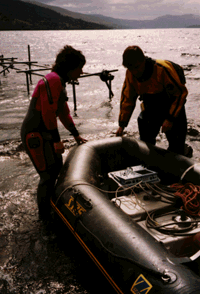
GPR is an established technique for looking through fresh water and it was used here with the antennas in the bottom of a small rubber boat, as shown.
Radar waves penetrate through fresh water and on through the loch bed.
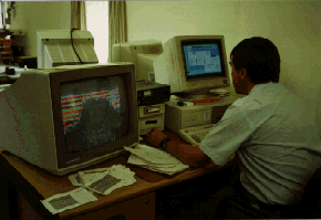
Results are recorded on site, and taken back to the office for computer processing and interpretation.
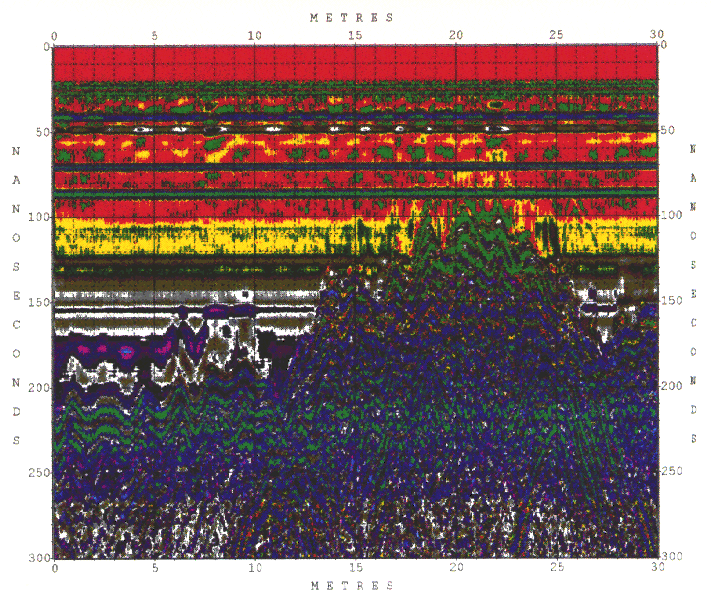
 Click here for the resulting GPR trace of the Loch Tay crannog.
The shape of the loch bed is clear against the horizontal lines of the water.
Individual targets create hyperbolas and the pattern is made up from all the hyperbolas from the rocks and timbers which make up the crannog.
Click here for the resulting GPR trace of the Loch Tay crannog.
The shape of the loch bed is clear against the horizontal lines of the water.
Individual targets create hyperbolas and the pattern is made up from all the hyperbolas from the rocks and timbers which make up the crannog.
For the full reference of this paper, please see
Publications
Note: this information is held at the University of Cambridge.
This paper was written while I was at Geospace Consultancy Services.